Createspace Independent Publishing Platform
2009 ORV Monitoring Results: Pyramid Peak Trail, Windy Creek Trail, and Cantwell Creek Floodplain Route: Cantwell Traditional Use Area, Denali Nati
Product Code:
9781491099162
ISBN13:
9781491099162
Condition:
New
$16.64
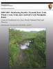
2009 ORV Monitoring Results: Pyramid Peak Trail, Windy Creek Trail, and Cantwell Creek Floodplain Route: Cantwell Traditional Use Area, Denali Nati
$16.64
The Final Determination for the Cantwell Traditional Use Area (TUA) allows subsistence users to operate off-road vehicles (ORV) within the Cantwell TUA for subsistence hunting purposes. Following this decision, Denali National Park and Preserve (DNP&P) established an ORV monitoring program to determine annual ORV use levels, track damage to resources and monitor the condition of open trails and routes with the Traditional Use Area. Of particular interest were identifying any severe impacts affecting trail sustainability or incursions beyond open established trails, as well as the amount of use on the open trails. We also seek to monitor the recovery of areas previously disturbed by ORVs upon closure to determine the rates of recovery of native vegetation in selected areas
| Author: National Park Service |
| Publisher: Createspace Independent Publishing Platform |
| Publication Date: Jul 31, 2013 |
| Number of Pages: 60 pages |
| Binding: Paperback or Softback |
| ISBN-10: 149109916X |
| ISBN-13: 9781491099162 |
Related Products