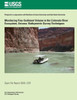
In 2002, a fine-grained sediment (sand, silt, and clay) monitoring effort was initiated in the Colorado River ecosystem, the river corridor downstream from Glen Canyon Dam, to directly survey channel topography at scales previously unobtainable in this canyon setting. This report presents an overview of the equipment and the methods used to collect and process the high-resolution bathymetric data required for this monitoring effort.
| Author: U. S. Department of the Interior |
| Publisher: Createspace Independent Publishing Platform |
| Publication Date: Feb 19, 2014 |
| Number of Pages: 38 pages |
| Binding: Paperback or Softback |
| ISBN-10: 1495930025 |
| ISBN-13: 9781495930027 |