")

")
Createspace Independent Publishing Platform
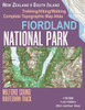
Fiordland National Park Trekking/Hiking/Walking Complete Topographic Map Atlas Milford Sound Routeburn Track New Zealand South Island 1:95000: Great ... Guide Hiking Maps for New Zealand Fjordland)
Product Code:
9781983679827
ISBN13:
9781983679827
Condition:
New
$17.28
Fiordland National Park Trekking/Hiking/Walking Complete Topographic Map Atlas Milford Sound Routeburn Track New Zealand South Island 1:95000: Great ... Guide Hiking Maps for New Zealand Fjordland)
$17.28
Updated 2018 edition. Complete map of the Fiordland National Park, NZ covering great walks and wonderful tramping/hiking trails in the area. Detailed topographic map 1:95.000 for hiking and trekking, printed as an atlas book (with overlapping pages). 20 meter contour lines, road network, trails & paths, transportation, food, campsites, shelters, guest houses & hotels. Mercator projection with both UTM and WGS84 coordinate grids. The map scale of 1:95000 (1 cm = 950 meters) provides a wealth of detail while keeping low the weight of the atlas itself. The large page format of 8.5x11in minimizes page count and along with an overlapping map design allows for comfortable navigation. The details included in the topographic maps of this atlas were specifically selected to be useful for trekkers, hikers and walkers of all interests, and make it easy to plan and enjoy both short excursions and hikes as well as long multi-day adventures along the main marked routes and/or adjacent trails and paths, which are also shown on the maps. With this ultralight atlas you will always have a detailed, reliable, information-rich, battery-independent, shatter-proof map for your adventure.
| Author: Sergio Mazitto |
| Publisher: CreateSpace Independent Publishing Platform |
| Publication Date: Jan 10, 2018 |
| Number of Pages: 46 pages |
| Language: English |
| Binding: Paperback |
| ISBN-10: 1983679828 |
| ISBN-13: 9781983679827 |
Related Products
")
Createspace Independent Publishing Platform
Kahurangi National Park Trekking/Hiking/Walking Complete Topographic Map Atlas Leslie-Karamea Track Mount Arthur New Zealand South Island 1:75000: ... (Travel Guide Hiking Maps for New Zealand)
$17.28
")
Createspace Independent Publishing Platform
Abel Tasman National Park Trekking/Hiking/Walking Topographic Map Atlas Abel Tasman Coast Track Awaroa Beach New Zealand South Island 1:25000: ... (Travel Guide Hiking Maps for New Zealand)
$17.28

